What do the Great Salt Lake and Prehistoric Lake Bonneville have in common?
The Great Salt Lake, located in the northern part of the state of Utah, is the largest salt water lake in the Western Hemisphere. It is considered to be the eighth-largest lake in the world. (The Great Salt Lake is considered a “terminal” lake, that is, what flows in does not flow out. The water that leaves the lake does so by evaporation.)
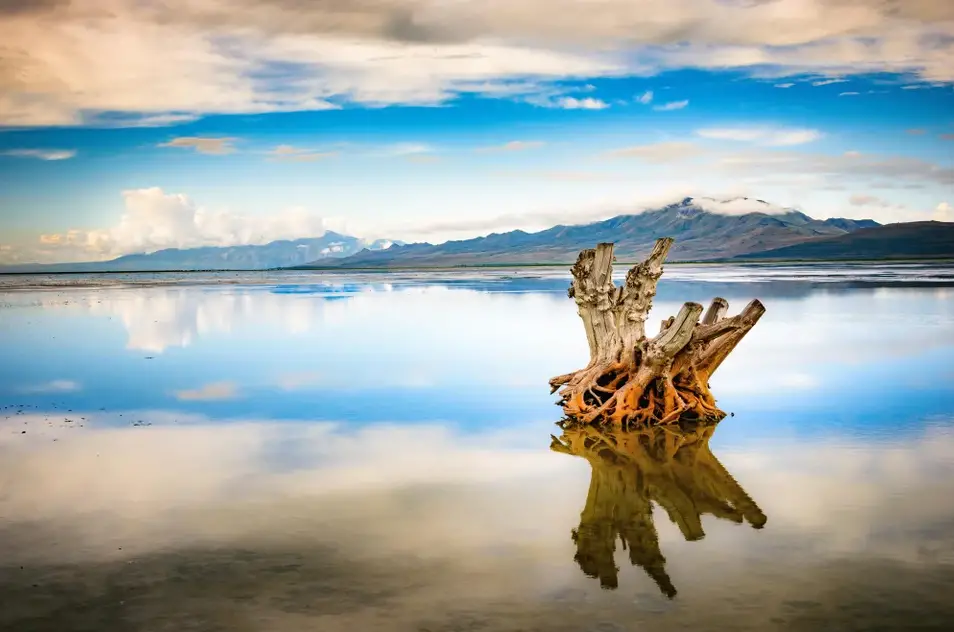
Photo – Zack Frank (Jan 2018)
In an average year, the lake covers an area around 1,700 square miles (4,400 km2). That’s about the same size as metropolitan Cleveland, Ohio. Because of evaporation and years of high precipitation, the lake’s size also fluctuates substantially. Why? Because the lake is very shallow.
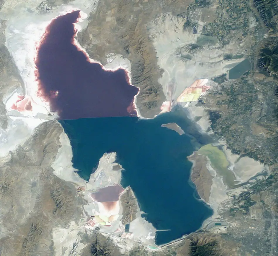
Photo – NASA
For instance, in 1963 it reached its lowest recorded size at 950 square miles (2,460 km²). But, in 1968, the surface area was at its historic high of 3,300 square miles (8,500 km2). In terms of surface area, it is the largest lake in the United States…that is not part of the Great Lakes region.
The Great Salt Lake is the modern day remnant of the ancient Lake Bonneville. They are one and the same. The size of the present-day lake is still large, but just not as big or as deep as the old lake. The shoreline of the ancient lake is still very visible on the sides of the nearby mountains.
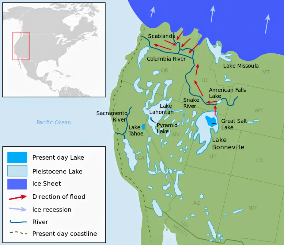
Prehistoric Lake Bonneville and the Present Day Great Salt Lake
Image – Wikipedia.org
The Great Salt Lake begins about 100 miles north of Salt Lake City. The southern shore ends not far from what is now the Salt Lake International Airport.
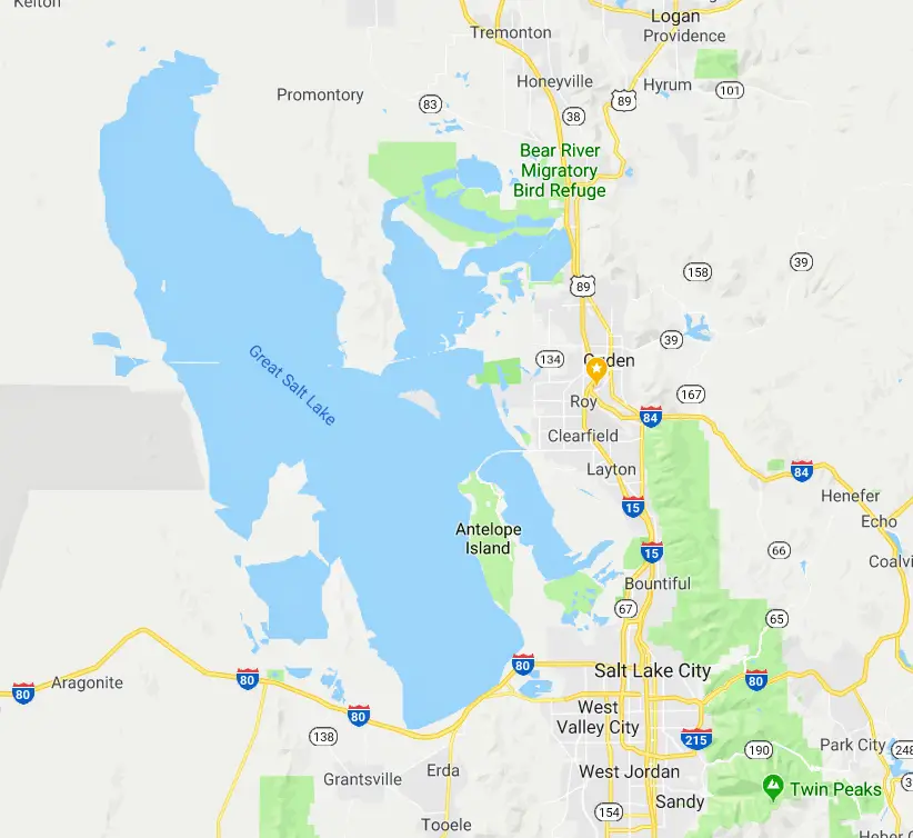
Source – Google Maps
When large populations of European settlers first came to the area in the late 1840’s, the lake became famous because people could simply lie back and float on the surface of the lake. This was because of high concentrations of salt left in the lake after the hot summer sun evaporated off a lot of the water flowing into it from the Bear River and the Weber River.
In modern times, there is sailing on the lake (even though it’s considered to be very shallow). Today, there are even dinner cruises offered by local tour operators.

Photo – Rick Egan (Jun 2013)

