Mount Timpanogos Legend: The Forgotten Secret of Utah’s Princess
The Majestic Backdrop of the Mount Timpanogos Legend
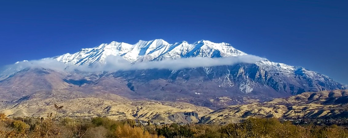
The Mount Timpanogos legend is more than just a local myth. Some consider it a visual masterpiece written in the skyline of the Wasatch Range. Mount Timpanogos, sometimes just called “Timp,” is the second highest mountain in Utah’s Wasatch Range. The Wasatch Mountains are those that run along the Salt Lake City area. Timpanogos rises to an elevation of 11,752 ft (3,582 m) above sea level in the Uinta-Wasatch-Cache National Forest. Timpanogos is estimated to be the 47th-most prominent mountain in the contiguous United States.
Highlights
- The Mount Timpanogos Legend: Discover the ancient folklore of the “Princess in Repose” and how her silhouette came to define the skyline of the Wasatch Range.
- The Peak’s Hidden History: Learn about the tragic 1955 B-25 plane crash on the mountain’s rugged slopes and how it remains a sobering part of the peak’s legacy.
- Geological Wonders: Explore the unique limestone formations and glacial cirques that make Mount Timpanogos one of the most distinct landmarks in the Intermountain West.
- A Scenic Landmark for Generations: See why this iconic peak, visible from the I-15 corridor, continues to capture the imagination of travelers and locals alike.
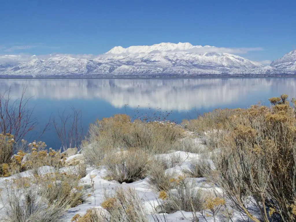
Photo – FRLambrechtsen (Feb 2018)
If you’re curious how Utah got its name, have a quick look here.
the Mount Timpanogos Legend: The Princess in Repose
“Timp” is actually closer to Provo, Utah. That’s approximately an hour south of Salt Lake City. The word Timpanogos comes from the Timpanogots tribe. They lived in the surrounding valleys from around AD 1400. The name translates as “rock” (tumpi-), and “water mouth” or “canyon” (panogos). At the southern or bottom end of “Timp” there is the Provo River. It flows through the Provo Canyon. At the top or northern end is the American Fork River. It flows through American Fork Canyon. Hence, the connection to “water mouth” and “canyon.” Many consider these canyons to be the most beautiful along the Wasatch Front.
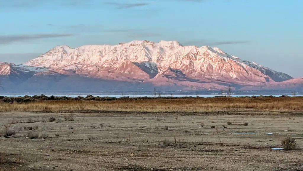
Photo – FRLambrechtsen (Dec 2018)
Ancient Limestone and Autumn Colors: Framing the Legend
Mt. Timpanogos looks imposing, but it’s actually pretty accessible. There are several doable hikes from both the front (west) and the back (east). Perhaps the most popular ascent is using the Timpooneke Trailhead. Getting there is through American Fork Canyon. The trailhead is part way up the back near the head of the reposing princess. It’s popular among local hikers to begin in the early hours of the morning to be at or near the summit when the sun comes up. After sunrise, it’s an amazing view to see Utah Valley and Utah Lake receiving their first light down below.
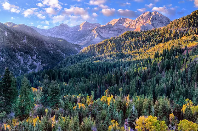
Photo – Douglas Pulsipher (Nov 2012)
If curious about hiking trails or outdoor adventures near “Timp,” review what’s here.
Tragedy on the Peak: The 1955 Crash Near the Legendary Summit
There are also some trails up “Timp” from the Sundance (east) side of the mountain. I haven’t done any of these myself, but I’ve heard these can be steeper. And after heavy winter snows, there is a glacier on the backside of “Timp” too. Also on the backside (east), near the summit, there are still a few remains of a World War II-era B-25 bomber that unfortunately crashed. That was March 1955. There was bad weather. The pilot became disoriented. Three crew members and two passengers were aboard. All perished.
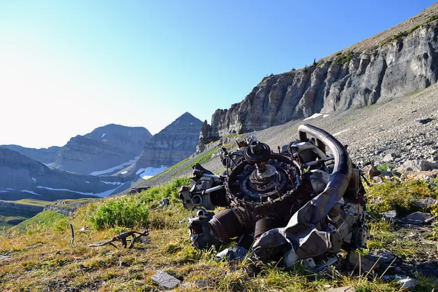
Photo – Brian Smith (Sep 2011)
Watching Over the Valley: Why the Mount Timpanogos Legend Endures
“Timp” is an imposing landmark in Utah’s Wasatch Front. She is especially beautiful after a snowstorm. The snow on “Timp” can last into late June or even early July, depending on the strength and frequency of winter storms. The mountain is clear of snow for a few months, but the snow can return as early as September. If you’re in the Salt Lake City area and have occasion Ito drive south, maybe to Zion National Park or some of the other national parks “down south,” stop in the northern part of Utah County and see if you can make out the “princess in repose.” This is now the Mount Timpanogos legend endures.
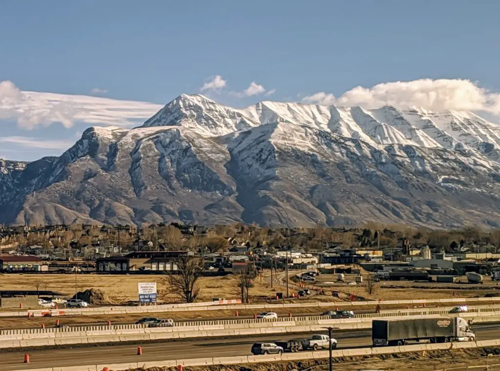
Photo – FRLambrechtsen (Dec 2018)
Discover more from TheCuriousOnlooker
Subscribe to get the latest posts sent to your email.


Beautiful photos!! I heard the legend of the princess often growing up close to Timp. Thanks for sharing. I love Mt. Timpanogos.
Thanks Cindy. Glad you liked the post. Timp is beautiful. She looks down prominently on the valley below.
With long flowing hair cascading toward Provo Canyon., she’s a beaut!
Thanks AB. She is beautiful. Got some shots of the backside of Timp recently. The mountain is beautiful from that side too. – F
Great post and amazing photos! Thanks for taking the time!
Apologies, Kerry, for the slow reply. Taking the time? It was my pleasure. I’m “curious” about these topics myself and enjoy putting these articles together.
I have a question that my family have light-heartedly quarreled about for some time: is the princess at rest with her head on the north end or south end? And investors states her knees are bent! Where is that 🤷♀️. Thanks
We’ve been told the princess is at rest with her head on the north. Bent knees? We’ve looked at “Timp” from the west side of Utah Lake many times. Honestly, we’ve never noticed any bent knees.